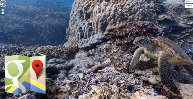
Google launches Maps Ocean, allows you to scuba dive into the Great Barrier Reef from your chair
Ever wanted to go scuba diving into the Great Barrier Reef, but never seem to have the money or time to undertake it? Don’t worry, Google has got you covered with its latest addition to the Google Maps service: underwater panorama and “Street View” of six of the world’s greatest underwater spots.

Sounds exciting, doesn’t it? That’s because it is and Google has gone into great depths (get it?) in making this possible. The places Google allows you to visit in its latest Maps feature include the Great Barrier Reef, and places in the Philippines and Hawaii.
Google has been partnering with The Catlin Seaview Survey, which is a major scientific study of the world’s reefs, and was using a specially designed underwater camera to capture the images you are about to see.
Here’s a promo video Google has made to celebrate the launch of the Google Maps Ocean.
Follow the source link below to experience the amazing footage yourself. Just take your oxygen tank with you, okay?
Featured
Categories
- Mobile phones
- Mobile software
- Mobile computers
- Rumors
- Fun stuff
- Various
- Android
- Desktop software
- Featured
- Misc gadgets
- Gaming
- Digital cameras
- Tablets
- iOS
- Desktop computers
- Windows Phone
- GSMArena
com - Online Services
- Mobile Services
- Smart Watches
- Battery tests
- BlackBerry
- Social Networks
- Web Browsers
- Portable Players
- Network Operators
- CDMA
- Windows
- Headphones
- Hands-on
 Oppo R1x battery life test
 Samsung Galaxy S6 updated to Android 5.1.1: exploring the differences on video
 Xiaomi Mi 4i battery life test
 Benchmarking Asus ZenFone 2 ZE551ML with Intel Atom Z3580 SoC and 4GB of RAM
 Lenovo A7000 Preview
Comments
Rules for posting